Severe Cyclonic Storm Hampers Monsoon Onset, Skymet Weather Predicts Meek Entry
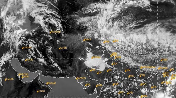
In a significant development, Cyclone ‘Biparjoy’ has rapidly intensified into a severe cyclonic storm over the east-central and adjoining southeast Arabian Sea. The Indian Meteorological Department (IMD) forecasts that it will further intensify into a very severe cyclonic storm within the next 12 hours. This intensification has raised concerns about its impact on the weather and monsoon progress in India.
Experts have noted that cyclonic storms in the Bay of Bengal and the Arabian Sea have been intensifying rapidly and sustaining their strength for longer durations, primarily due to the effects of climate change. ‘Biparjoy,’ being a powerful weather system, is expected to critically influence the advancement of the monsoon towards the Kerala coast.
The onset of the southwest monsoon in Kerala has already been delayed, and the IMD has not yet provided a tentative date for its arrival. However, private forecasting agency Skymet Weather suggests that the monsoon may make a “meek and mild entry” on June 8 or June 9. The presence of powerful weather systems in the Arabian Sea hampers the monsoon’s progress deep inland, making it challenging for the monsoon stream to penetrate beyond the Western Ghats, as explained by Skymet Weather.
Normally, the southwest monsoon arrives over Kerala by June 1, with a standard deviation of approximately seven days. The IMD had initially predicted the monsoon’s arrival in the southern state by June 4. While the formation of a low-pressure system in the Arabian Sea delayed the monsoon’s onset in Kerala, experts emphasize that this delay does not necessarily mean a late arrival of the monsoon in other parts of the country. Furthermore, it does not impact the total rainfall expected across the country during the season.
The cyclonic storm ‘Biparjoy’ has prompted wind warnings for the upcoming days. Gale wind speeds ranging from 70-80 kmph, gusting to 90 kmph, are currently prevailing over the east-central Arabian Sea and adjoining areas of west-central and southeast Arabian Sea. These wind speeds are expected to increase significantly, reaching 105-115 kmph, gusting to 125 kmph, from the evening of June 7 over the same area.
On June 8, squally wind speeds of 40-50 kmph, gusting to 60 kmph, are likely along and off the Karnataka-Goa-Maharashtra coasts. These wind conditions are expected to persist for the next four days along these coastal regions.
Authorities and residents in the affected areas are advised to stay updated with the latest weather information and take necessary precautions to ensure their safety. Fishermen have been advised not to venture into the sea during this period of intensified weather conditions.
As Cyclone ‘Biparjoy’ continues to intensify and impact the progress of the southwest monsoon, meteorological agencies will closely monitor its trajectory and issue regular updates to provide accurate information and forecasts to the public and concerned authorities.
It is crucial for everyone to remain vigilant and follow the instructions of local authorities to mitigate the potential risks associated with severe weather conditions caused by the cyclonic storm ‘Biparjoy.’


